Introduction
What is DSS-WISE Web? DSS-WISE Lite?
DSS-WISE (Decision Support System for Water Infrastructural Security) is the dam-break/levee-breach flood modeling and mapping core consisting of powerful preprocessing tools, fast and robust simulation engine, consequence analysis tools, and vast technical expertise of The National Center for Computational Hydroscience and Engineering (NCCHE) at the University of Mississippi.
DSS-WISE Lite was originally a reduced-functionality subset of the core numerical DSS-WISE tools that were made available on a web platform. This reference has since been deprecated and replaced with DSS-WISE Web as development continues on the online system's capabilities.
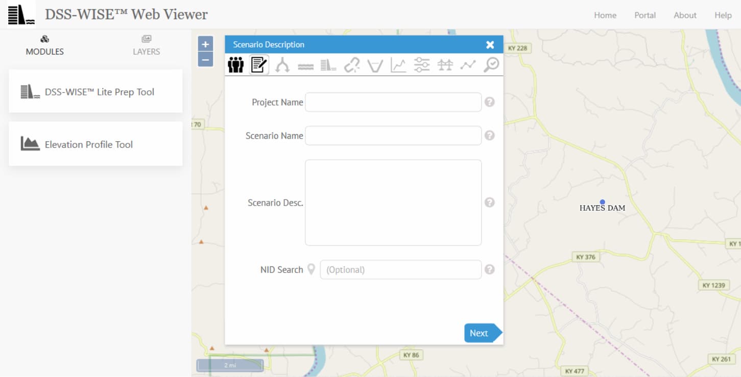
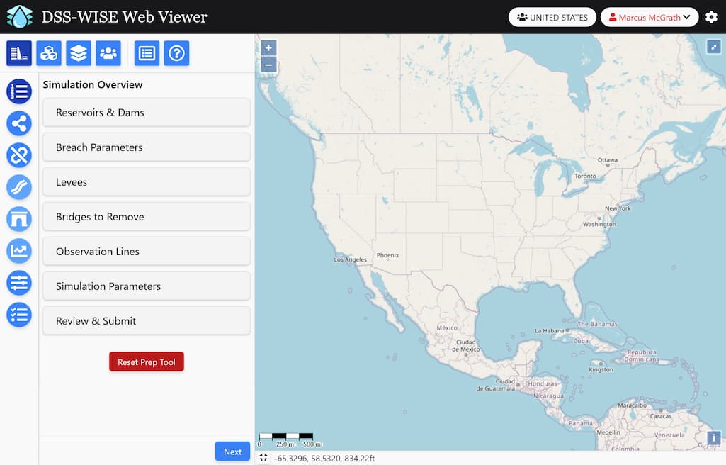
DSS-WISE Web is the Internet-based arm of DSS-WISE which provides access to a secure, web-based environment consisting of a graphical user interface and map server used to set up fully-automated two-dimensional dam-break/levee-breach modeling and mapping at various resolutions currently available 24/7 and free of charge. After being accepted in a group through the Group Management module, users have access to the Prep Tool module and simulation results module. The DSS-WISE Web Prep Tool is a graphical user interface (GUI) with minimized user input and real-time error checking that provides quick and intuitive simulation setup in 12 easy steps.
When a user submits a simulation request, the information is sent to the servers at NCCHE housing DSS-WISE Web. This data is automatically enhanced with information from national databases including the National Inventory of Dams, National Levee Database, National Bridge Inventory, United States Geological Survey National Elevation Dataset Digital Elevation Models (DEMs), and National Landcover Database.
A set of robust and efficient preprocessing steps ensures that the information is valid, and takes all possible manner of corrective measures drawn from NCCHE's vast experience in flood modeling. Within minutes, NCCHE's state-of-the-art numerical flood model, DSS-WISE, begins calculation and returns the first set of results of the flood scenario set up by the user. The computational engine has been optimized to fully utilize all available compute resources, resulting in unprecedented completion times of less than an hour in 80% of cases. The flood model utilizes an extremely robust finite-volume discretization with a shock-capturing upwind scheme that is used to solve full dynamic shallow water equations over natural topography with wetting and drying. The user stays informed of simulation progress via a rich status and results page, and when finished, the system automatically provides the following results files:
System Output Files:
- An automatically generated PDF report, which summarizes the input data and the results. The report includes the maps of maximum flood depth and flood arrival time, the plots of the hydrographs at the observation points, etc.
- A polygon shapefile of the inundation extents.
- A Google Earth KMZ file of the inundation extent which can be used for dissemination of results.
- Filled polygons of the arrival time and maximum flood depths at intervals compatible with the Consequence Top Screen (CTS) as polygon shapefiles.
- Shapefiles of simulation set up (reservoir point, dam crest lines, breach locations, user-drawn levees, and observation lines).
- Comma-separated value (CSV) tabular text files of hydrographs recorded at observation lines. It should be mentioned that for reservoir-type simulations, DSS-WISE Web automatically provides an additional observation line coinciding with the user-specified crest line of the breached dam. This observation line provides the breach hydrograph.
- Raster results files, which include the maximum flood depth, arrival time, and the DEM used as computational grid.
DSS-WISE Web Alignment with National Dam Safety Program
The Federal government has been using the "National Dam Safety Program (NDSP)" to protect Americans from potential dam failures for the last 30 years. The objectives of NDSP are to:
- ensure that new and existing dams are safe through the development of technologically and economically feasible programs and procedures for national dam safety hazard reduction;
- encourage acceptable engineering policies and procedures to be used for dam site investigation, design, construction, operation and maintenance, and emergency preparedness;
- encourage the establishment and implementation of effective dam safety programs in each state based on state standards;
- develop and encourage public education and awareness projects to increase public acceptance and support of state dam safety programs;
- develop technical materials for Federal and state dam safety programs;
- develop mechanisms with which to provide Federal technical assistance for dam safety to the non-Federal sector; and
- develop technical assistance materials, seminars, and guidelines to improve security for dams in the United States.
Three of the five 2014-2018 FEMA Strategic Plan priorities established by the FEMA Leadership are supported by the NDSP:
- Be Survivor-Centric in Mission and Program Delivery,
- Posture and Build Capability for Catastrophic Disasters, and
- Enable Disaster Risk Reduction Nationally.
The National Dam Safety Review Board (Review Board), monitors the safety of dams in the United States, the States implementation of NDSP requirements and advises the FEMA Administrator on national dam safety policy, and the Interagency Committee on Dam Safety (ICODS), which coordinates among Federal agencies on dam safety issues and collaborates with the Review Board to ensure consistency and support between the Federal and non-Federal elements within the dam community, are both chaired by FEMA.
Moreover, under the National Dam Safety Program Act, FEMA has a statutory requirement at 33 U.S.C. § 467 : US Code - Section 467G-1 (Training) to, at the request of any State that has or intends to develop a State dam safety program, provide training for State staff dam safety and inspectors. FEMA also has a statutory requirement at 33 U.S.C. 467G (Research) to carry out a program of technical and archival research to develop and support:
- Improved techniques, historical experience, and equipment for rapid and effective dam construction, rehabilitation, and inspection;
- Devices for the continued monitoring of the safety of dams;
- Development and maintenance of information resources systems needed to support managing the safety of dams; and
- Initiatives to guide the formulation of effective public policy and advance improvements in dam safety engineering, security, and management.
Who Would Benefit from DSS-WISE Web?
DSS-WISE Web is designed to benefit stakeholders of the dam sector: notably state dam safety offices, Federal Emergency Management Agency personnel, stakeholders of government agencies, United States Army Corps of Engineers, United States Bureau of Reclamation, Federal Energy Regulatory Commission, United States Department of Agriculture, floodplain managers, and emergency response planners.
Capabilities
24/7 Availability
Available to users around the clock and accessible online
Fast Setup
Quick and easy model configuration
Robust Solver
Extremely fast, automated, fully-verified and validated numerical solver
Emergency Ready
Capable of supporting real-time emergency situations
Comprehensive Results
Detailed, GIS-compatible model results package immediately ready to be integrated into your consequence analysis or inundation mapping efforts
History
NCCHE is established
The DSS-WISE Lite system was developed by NCCHE, which was established in 1982 as a research unit in the School of Engineering at The University of Mississippi, by the State of Mississippi's Institutions of Higher Learning Board of Trustees.
DSS-WISE develops under SERRI
DSS-WISE™ started in 2007 as a desktop GIS-based software package developed under South East Region Research Initiative (SERRI) funded by the Department of Homeland Security and monitored by the Oak Ridge National Laboratory.
DSS-WISE Lite development begins
During 2011, NCCHE began developing a web-based version of DSS-WISE to serve a broader user community with minimal required technical background in flood modeling. These efforts would eventually be supported by DHS S&T and grow into what is now known as DSS-WISE Lite. DSS-WISE Lite is a unique system not only in the USA but also in the world. There is no other example of a geospatial, web-based automated dam-break flood simulation and mapping system that operates without human intervention. The University of Mississippi holds the copyrights and the original core development team at NCCHE holds the intellectual property rights.
DSS-WISE Lite available under DSAT
During the period February 2012-November 2014, dam safety offices were able to access the DSS-WISE Lite system through the DHS Dam Sector Analysis Tools (DSAT) to perform sunny day breach scenarios of the dams under their portfolio free of charge.
DSS-WISE Lite under DSAT ceases
As of November 14, 2014, the system had received a total of 3020 dam break simulations from 41 States, averaging about 154 per month. As evidenced by testimonials provided by 11 state dam safety offices in November 2014, these web-based, automated dam break simulations that were available 24/7 have proven beneficial to State dam safety offices. The DSS-WISE Lite system increased the amount of emergency action plan (EAP) compliance for high hazard potential dams, which is a priority and performance metric for FEMA's National Dam Safety Program. The DSAT system that resided on a server hosted by the Argonne National Laboratory and provided access to the DSS-WISE Lite is now being transitioned to U.S. Army Corps of Engineers (USACE). USACE has made significant changes to adapt DSAT to its mission, and its access will only be provided to USACE engineers and stakeholders. As a result, the DSS-WISE Lite capability is no longer available under DSAT.
DSS-WISE Lite development under FEMA begins
In September 2015, NCCHE was awarded a sole source contract by the Federal Emergency Management Agency (FEMA) to develop a standalone web portal with map server and GUI to provide web-based automated dam-break flood modeling and mapping services using DSS-WISE Lite.
DSS-WISE Lite initial beta testing
In August 2016, the beta test version of the DSS-WISE Lite portal (now known as DSS-WISE Web) became available to selected users from different states. The beta-test period was scheduled to terminate at the end of September 2016. At the beginning of October, when extensive flooding caused by Hurricane Matthew created emergency conditions for numerous dams in South Carolina and North Carolina, the beta test period was extended to allow continued access to DSS-WISE Lite.
DSS-WISE Lite 1.0 released
The live system of DSS-WISE Web portal providing access to DSS-WISE Lite web-based automated dam-break capability became available on November 8, 2016, with a completely redesigned GUI, a self-governed user management system, and numerous improvements.
DSS-WISE Lite 2.0 released
Version 2.0 of the system included a redeisgn of the Viewer and a new set of tools to greatly enhance the simulation setup process, including an elevation profile tool.
DSS-WISE HCOM released
HCOM (Human COnsequence Module), which provides information about the human consequences of floods, is released. Results include Population At Risk (PAR) counts for both daytime and nighttime, a new detailed PDF report, and various GIS outputs.
DSS-WISE Web 3.0 released
Version 3.0 of the system included a completely redesigned Viewer with vast improvements over previous releases. Notable additions were capabilities to model dams in series, impose user-defined levees into the terrain, and a new partial breach parameter calaculator.
DSS-WISE Web sets new record with 858 simulations in a single day
DSS-WISE Web processes 858 simulation submissions, setting a new record for the system, and demonstrating its speed and resilience.
DSS-WISE Web 4.0 beta released
This Beta release brings a complete rewrite of the front-end and back-end systems powering DSS-WISE Web as a stand-alone system running in parallel with the existing version 3.0 system, including a new, consolidated web framework called SvelteKit which powers a seamless transition between various parts of the web interface and group enrollment and details. The external data layers for DEM elevation, map backgrounds, etc. were brought in-house as part of the back-end upgrades to enable complete control of what the users see and interact with. The USGS 3DEP one-meter lidar-derived elevation datasets were integrated with a new data flow and frequent update capability, bringing a vast array of high-quality data into the system for visualization and simulations. In addition, this release brings a new fair queuing system for simulation ordering, a levee breach module, and a myriad of other improvements.
DSS-WISE Web system remains in operation and under development
The live system of DSS-WISE Web continues to provide service to the dam safefy community of the United Sates. The next release, version 4.1, is under heavy development. This future release will bring cascading dam failures, with each breach having a number of triggering conditions, hydrograph inflow sources for watersheds and wet-day scenarios, and the ability to include culverts in simulations.
Development Team
DSS-WISE Web was developed by a small team of passionate and dedicated engineers, researchers, and programmers at the National Center for Computational Hydroscience and Engineering at the University of Mississippi. You can find out more about the development team behind DSS-WISE Web by clicking here.
Technology
DSS-WISE Web runs on a small cluster of dedicated hardware at NCCHE's compute facilities. The software is a set of state-of-the-art proprietary pre- and post-processing modules and numerical models supported by a host of Open Source Software. To the greatest extent possible, we tried to maximize the use of Open Source Software to leverage community expertise, reduce cost, and extract the most flexibility and control over the code running our system.
Publication
If you publish a paper involving DSS-WISE Web, we would love to hear about it! Please send us a notification or copy of any published papers to the contact below.
Trademark
The name "DSS-WISE" is a trademark of NCCHE.
Contact
You can direct questions, comments, feedback, bug reports, and general correspondence via information found on the contact page. One of the DSS-WISE Web team members will respond as soon as possible.